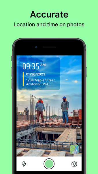
Geotag Map Camera - GPS Camera: Ideal for Travel Memories
Geotag Map Camera is a multimedia app for iPhone that enhances your travel photos by adding geolocation data. Users can easily integrate DateTime, latitude, longitude, altitude, and weather information to their images, making it perfect for documenting adventures. The app tracks live location and provides weather forecasts, allowing users to share their experiences with family and friends through geotagged photos and videos.
The application offers a variety of features, including automatic compass directions, magnetic field details, humidity, wind speed, and pressure measurements. Users can select from different templates, such as Travel and Weather, to customize their photos. With its user-friendly interface, Geotag Map Camera is an essential tool for travelers looking to enrich their memories with detailed geolocation information.